Drone Roof Inspection & Measurement
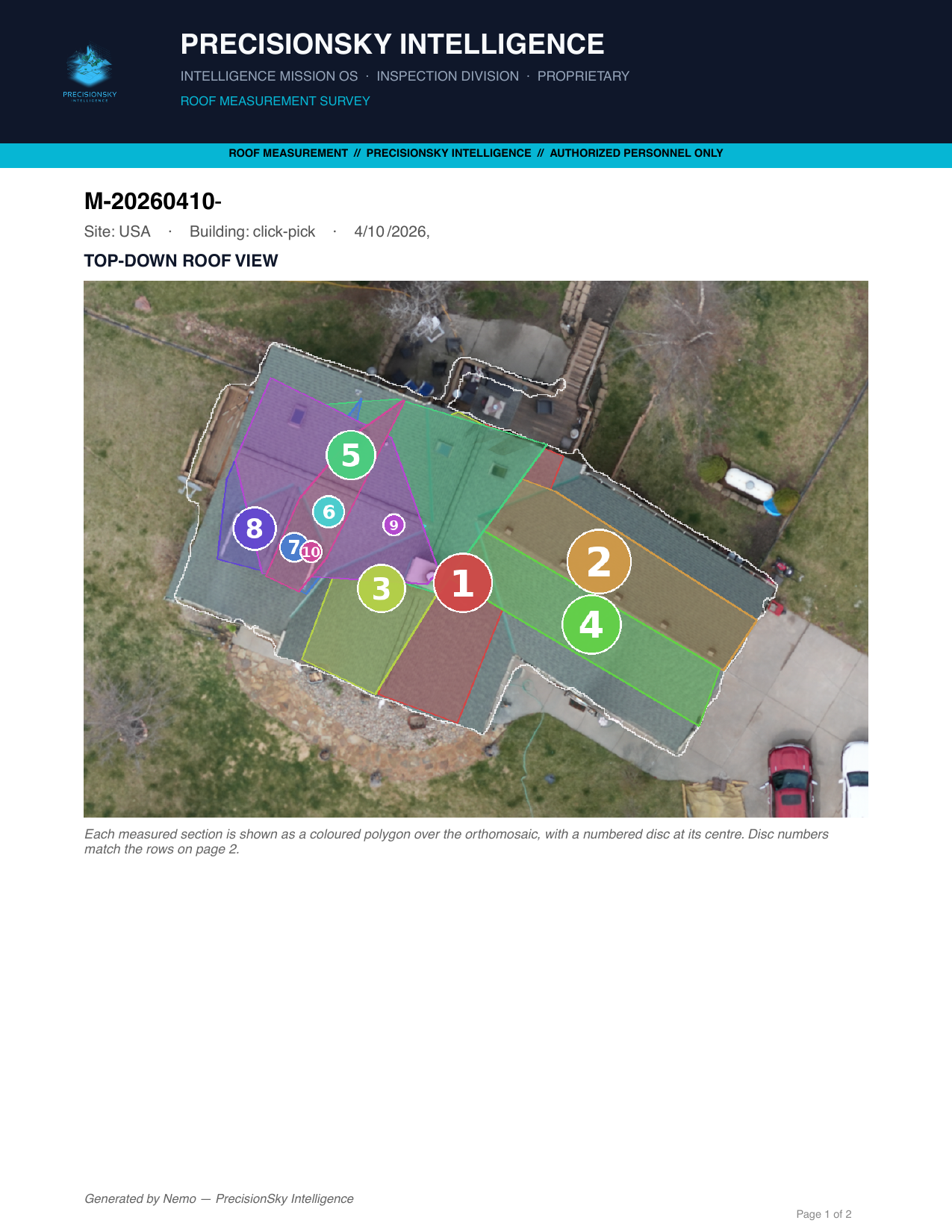
We fly the roof with a 61-megapixel camera and deliver it the way an estimator reads it: facet by facet, with measured areas and pitch stated as a ratio — 6/12, 9/12 — not degrees.
What you get
- A roof measurement report (PDF): every facet labeled, with area and pitch per facet — see a sample report
- Annotated condition photos with numbered markers and a findings legend, so a photo and its finding never get separated
- A full-resolution top-down orthomosaic of the structure
- A browsable 3D model of the roof and building
- Optional radiometric thermal pass on flat and low-slope roofs, where heat patterns can indicate trapped moisture
Why a drone instead of a ladder
Nobody has to walk a steep, wet, or hail-damaged roof to document it. The whole surface is captured in one flight, every photo is geotagged, and the condition of the roof is on record before anyone touches it — which matters when the report supports an insurance claim or a contract dispute.
Roofing contractors use these reports to quote without a site revisit. Property managers and owners use them to document storm damage while it is still fresh.
Contact
Call or email and you talk to the people who fly and process the job.
Gary Ostwald — Founder / Chief Pilot · (402) 941-4209 · gary@precisionskyintelligence.ai
Tracey Stevens — Co-Founder / COO · (925) 787-3028 · tracey@precisionskyintelligence.ai
Offices in Weston, Nebraska and Dripping Springs, Texas. Service area: nationwide.
Aerial Intelligence with evidence — not just photos.